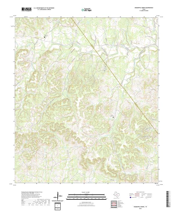
2022 Map of Crabapple Creek
USGS Topo · Published 2022About this map
The winding Blanco River and its several forks define this central Texas landscape, where the boundary between Kendall and Blanco counties cuts diagonally through the hills. This modern topographic survey illustrates a rural terrain deeply carved by water, featuring numerous drainages such as Crabapple Cr, Curry Cr, and Little Blanco River. Family history and local heritage are anchored by small, documented burial grounds including the Beck-Kuebel Cem and Givens-Bindseil Cem.
Find a feature on this map
46 named features on this map. Tap any name to fly to it.
Don’t see what you’re looking for? This feature index may not catch every label — zoom into the map to look around manually.
Map Details
Editions of this 2022 Crabapple Creek Map
This is the sole edition of this map. No revisions or reprints were ever made.
Other maps of this area

1887 · Blanco
USGS Topo · 1:125,000

1894 · Fredericksburg
USGS Topo · 1:125,000

1894 · Blanco
USGS Topo · 1:125,000

1920 · Smithsons Valley
USGS Topo · 1:62,500

1927 · Smithson Valley
USGS Topo · 1:62,500

1929 · Smithson Valley
USGS Topo · 1:62,500

1940 · Smithson Valley
USGS Topo · 1:62,500

1954 · Llano
USGS Topo · 1:250,000

1954 · San Antonio
USGS Topo · 1:250,000

1955 · Llano
USGS Topo · 1:250,000