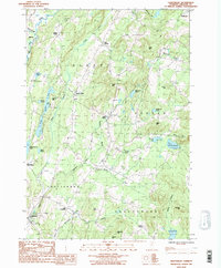
1986 Map of Craftsbury
USGS Topo · Published 1987About this map
The Black River valley defines the character of this mid-1980s Vermont landscape, where agricultural tradition and small hamlets cluster along the river and its tributaries. The settlement pattern is rooted in historic crossroads, with small population centers like Albany, East Albany, and Craftsbury serving as anchors for the surrounding rural roads. The area is characterized by numerous small ponds and brooks that feed the river system, including the distinctive Little Hosmer Pond and Hosmer Pond near the village of Mill Village.
Find a feature on this map
45 named features on this map. Tap any name to fly to it.
Don’t see what you’re looking for? This feature index may not catch every label — zoom into the map to look around manually.
Map Details
Editions of this 1986 Craftsbury Map
2 editions found
Other maps of this area

1919 · Lake Memphremagog
USGS Topo · 1:62,500

1920 · Derby
USGS Topo · 1:62,500

1920 · Irasburg
USGS Topo · 1:62,500

1923 · Irasburg
USGS Topo · 1:48,000

1923 · Lake Memphremagog
USGS Topo · 1:48,000

1925 · Irasburg
USGS Topo · 1:62,500

1925 · Memphremagog
USGS Topo · 1:62,500

1928 · Hardwick
USGS Topo · 1:62,500

1934 · Hardwick
USGS Topo · 1:48,000

1935 · Lyndonville
USGS Topo · 1:48,000