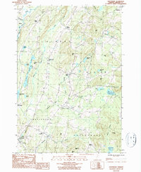
1986 Map of Craftsbury
USGS Topo · Published 1987About this map
The Black River valley defines the character of this mid-1980s landscape, winding through a series of agrarian settlements and glacial ponds in the heart of Orleans County. The town of Craftsbury and its neighbor East Craftsbury anchor the southern portion of the sheet, where Whetstone Brook and Whitney Brook feed into the river system. This region is marked by its traditional Vermont hamlet structure, with clusters of development at Albany, East Albany, and South Albany connected by a network of rural roads.
Find a feature on this map
46 named features on this map. Tap any name to fly to it.
Don’t see what you’re looking for? This feature index may not catch every label — zoom into the map to look around manually.
Map Details
Editions of this 1986 Craftsbury Map
2 editions found
Other maps of this area

1919 · Lake Memphremagog
USGS Topo · 1:62,500

1920 · Derby
USGS Topo · 1:62,500

1920 · Irasburg
USGS Topo · 1:62,500

1923 · Irasburg
USGS Topo · 1:48,000

1923 · Lake Memphremagog
USGS Topo · 1:48,000

1925 · Irasburg
USGS Topo · 1:62,500

1925 · Memphremagog
USGS Topo · 1:62,500

1928 · Hardwick
USGS Topo · 1:62,500

1934 · Hardwick
USGS Topo · 1:48,000

1935 · Lyndonville
USGS Topo · 1:48,000