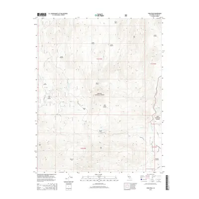
2015 Map of Crag Peak
USGS Topo · Published 2015About this map
Kennedy Meadows and Rodeo Flat anchor this high-elevation landscape within the Sequoia National Forest and Inyo National Forest. The 2015 topography is defined by the headwaters of the S Fork Kern River and a series of subalpine meadows including Jackass Meadows, Troy Meadow, and Corral Meadow. This area represents a critical corridor for mountain travel, evidenced by the winding path of the Pacific Crest National Scenic Trail as it traverses the eastern edge of the quadrangle. Significant peaks and passes, such as Crag Peak, Pine Mtn, and Bakeoven Pass, illustrate the complex drainage systems of Fish Cr and Jackass Cr. The presence of established routes like Sherman Pass Rd and Co Road J41 reflects the modern infrastructure supporting access to these interior Sierra Nevada landmarks.
Find a feature on this map
34 named features on this map. Tap any name to fly to it.
Don’t see what you’re looking for? This feature index may not catch every label — zoom into the map to look around manually.
Map Details
Editions of this 2015 Crag Peak Map
This is the sole edition of this map. No revisions or reprints were ever made.
Other maps of this area

1905 · Olancha
USGS Topo · 1:125,000

1906 · Kernville
USGS Topo · 1:125,000

1907 · Olancha
USGS Topo · 1:125,000

1908 · Kernville
USGS Topo · 1:125,000

1948 · Bakersfield
USGS Topo · 1:250,000

1948 · Fresno
USGS Topo · 1:250,000

1955 · Bakersfield
USGS Topo · 1:250,000

1955 · Fresno
USGS Topo · 1:250,000

1956 · Bakersfield
USGS Topo · 1:250,000

1956 · Fresno
USGS Topo · 1:250,000