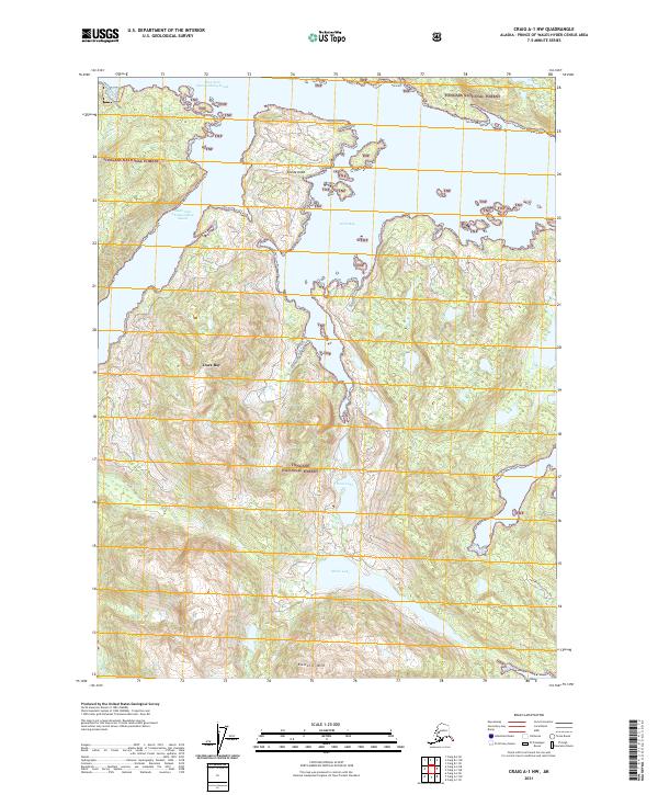
2021 Map of Craig A-1 NW
USGS Topo · Published 2021About this map
Tongass National Forest encompasses the entirety of this coastal Alaskan landscape, where the intricate maritime topography of Prince of Wales Island is defined by deep fjords and interior freshwater bodies. The narrow Divide Head peninsula separates the waters of West Arm Cholmondeley Sound and Dora Bay, illustrating the complex glacial carving of the shoreline. To the south, a chain of inland water includes Dora Lake and Miller Lake, which sit in the shadow of high peaks like Eudora Mtn. This area is characterized by its lack of established roads and settlements, representing a wilderness state focused on the intersections of the South Arm Cholmondeley Sound and the timbered heights of the forest.
Find a feature on this map
15 named features on this map. Tap any name to fly to it.
Don’t see what you’re looking for? This feature index may not catch every label — zoom into the map to look around manually.
Map Details
Editions of this 2021 Craig A-1 NW Map
This is the sole edition of this map. No revisions or reprints were ever made.
Other maps of this area

1948 · Craig A-1
USGS Topo · 1:63,360

1948 · Craig A-2
USGS Topo · 1:63,360

1949 · Craig B-2
USGS Topo · 1:63,360

1949 · Craig B-1
USGS Topo · 1:63,360

1950 · Craig B-1
USGS Topo · 1:63,360

1951 · Craig B-2
USGS Topo · 1:63,360

1951 · Craig A-2
USGS Topo · 1:63,360

1957 · Craig
USGS Topo · 1:250,000
1996 · Craig A-2
USGS Topo · 1:63,360
1997 · Craig A-1
USGS Topo · 1:63,360