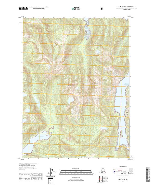
2021 Map of Craig A-2 NE
USGS Topo · Published 2021About this map
The southeastern coast of Prince of Wales Island is defined here by the intricate shoreline of the Tongass National Forest. This 2021 survey focuses on a largely untouched wilderness within the Alexander Archipelago, where the waters of Cholmondeley Sound reach deep into the mountainous island interior. The eastern edge of the map reveals the South Arm Cholmondeley Sound, a major waterway for marine navigation and local ecology. Inland, the terrain is dominated by steep forested ridges drained by freshwater systems like Big Cr. The lack of road infrastructure and human settlements highlights the region's character as a protected natural resource and a sanctuary for Pacific Northwest coastal biodiversity.
Find a feature on this map
11 named features on this map. Tap any name to fly to it.
Don’t see what you’re looking for? This feature index may not catch every label — zoom into the map to look around manually.
Map Details
Editions of this 2021 Craig A-2 NE Map
This is the sole edition of this map. No revisions or reprints were ever made.
Other maps of this area

1948 · Craig A-1
USGS Topo · 1:63,360

1948 · Craig A-2
USGS Topo · 1:63,360

1949 · Craig B-2
USGS Topo · 1:63,360

1949 · Craig B-1
USGS Topo · 1:63,360

1950 · Craig B-1
USGS Topo · 1:63,360

1951 · Craig B-2
USGS Topo · 1:63,360

1951 · Craig A-2
USGS Topo · 1:63,360

1957 · Craig
USGS Topo · 1:250,000
1996 · Craig A-2
USGS Topo · 1:63,360
1997 · Craig A-1
USGS Topo · 1:63,360