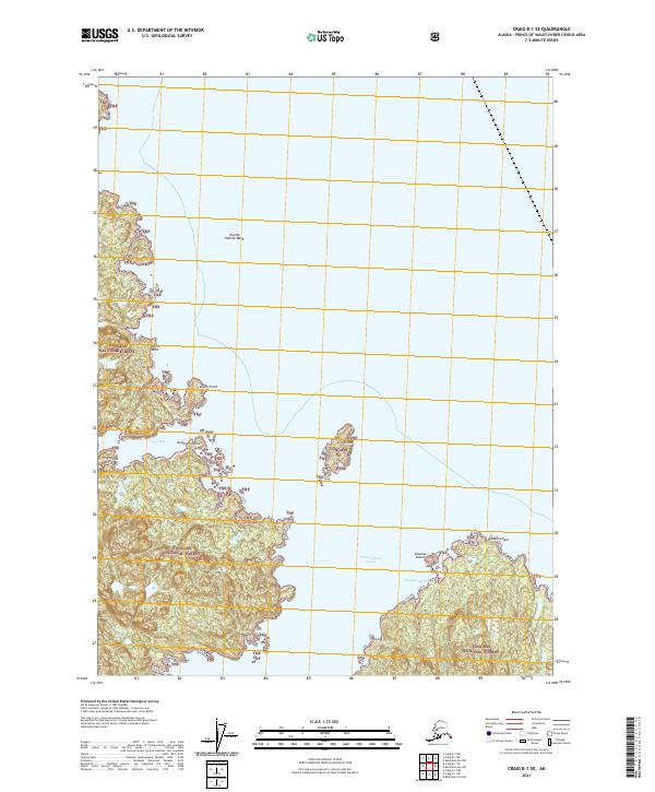
2021 Map of Craig B-1 SE
USGS Topo · Published 2021About this map
Tongass National Forest dominates this coastal landscape in the Alexander Archipelago, showing the intricate relationship between the temperate rainforest and the Pacific. The intricate shoreline is defined by protected inlets like Clover Bay and the broad waters of Cholmondeley Sound, providing natural shelter for maritime navigation. Small coastal landmarks such as King Island and Skin Island break the water's surface, while the depth of the surrounding sea is marked by features like Twenty Fathom Bank. This topography highlights the vital importance of protected moorings in Southeast Alaska, with Chasina Anchorage serving as a primary point of refuge along the jagged coast of the Prince of Wales-Hyder region. The map documents the coastal geography from Doctor Point in the north down to Chasina Point, offering a detailed view of the terrain before it reaches the deeper ocean channels.
Find a feature on this map
17 named features on this map. Tap any name to fly to it.
Don’t see what you’re looking for? This feature index may not catch every label — zoom into the map to look around manually.
Map Details
Editions of this 2021 Craig B-1 SE Map
This is the sole edition of this map. No revisions or reprints were ever made.
Other maps of this area

1948 · Ketchikan A-6
USGS Topo · 1:63,360

1948 · Craig A-1
USGS Topo · 1:63,360

1949 · Craig B-1
USGS Topo · 1:63,360

1950 · Craig B-1
USGS Topo · 1:63,360

1952 · Ketchikan
USGS Topo · 1:250,000

1953 · Ketchikan B-6
USGS Topo · 1:63,360

1954 · Ketchikan B-6
USGS Topo · 1:63,360

1955 · Ketchikan
USGS Topo · 1:250,000

1957 · Craig
USGS Topo · 1:250,000
1994 · Ketchikan B-6
USGS Topo · 1:63,360