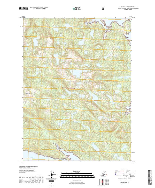
2021 Map of Craig B-1 SW
USGS Topo · Published 2021About this map
The Alexander Archipelago within the Tongass National Forest presents a complex maritime landscape of deep inlets and high peaks. This southeastern Alaska terrain is dominated by the drainage system of Clover Creek, which flows out of Clover Lake and the slopes of Clover Mtn. The shoreline is heavily indented with protected waters such as Trollers Cove and Sunny Cove, offering a detailed view of the coastal geography before the northern reaches of the West Arm Cholmondeley Sound. High points like Nipple Butte and Island Point provide significant navigational and geographic landmarks for this roadless wilderness. The map documents the intricate network of small water bodies like Monie Lk and seasonal drainage including Sunny Cr, illustrating the dense hydrological profile of Prince of Wales Island.
Find a feature on this map
17 named features on this map. Tap any name to fly to it.
Don’t see what you’re looking for? This feature index may not catch every label — zoom into the map to look around manually.
Map Details
Editions of this 2021 Craig B-1 SW Map
This is the sole edition of this map. No revisions or reprints were ever made.
Other maps of this area

1948 · Craig A-1
USGS Topo · 1:63,360

1948 · Craig A-2
USGS Topo · 1:63,360

1949 · Craig B-2
USGS Topo · 1:63,360

1949 · Craig B-1
USGS Topo · 1:63,360

1950 · Craig B-1
USGS Topo · 1:63,360

1951 · Craig B-2
USGS Topo · 1:63,360

1951 · Craig A-2
USGS Topo · 1:63,360

1957 · Craig
USGS Topo · 1:250,000
1996 · Craig A-2
USGS Topo · 1:63,360
1997 · Craig A-1
USGS Topo · 1:63,360