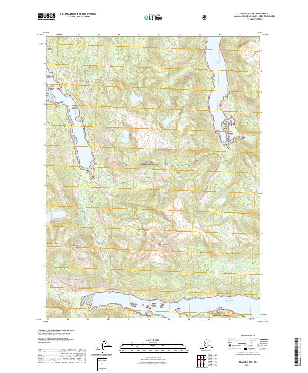
2021 Map of Craig B-2 SE
USGS Topo · Published 2021About this map
Tongass National Forest dominates this section of Prince of Wales Island, where the complex coastline of Southeast Alaska is defined by deep fjords and maritime waterways. The landscape transitions from the saltwater depths of McKenzie Inlet and the West Arm Cholmondeley Sound to prominent heights like Beaver Mtn and Barren Mtn. This environment is shaped by high-elevation terrain and a network of drainages, including Polk Creek and Sunny Cr, which feed the surrounding inlets. Interior access is documented through forest routes such as the Mckenzie 2156000 Road Trl, highlighting the intersection of industrial management and the wilderness of the Alexander Archipelago. Isolated landmarks like Rock Butte and Peacock Island further illustrate the fragmented, glaciated geography typical of this coastal region.
Find a feature on this map
19 named features on this map. Tap any name to fly to it.
Don’t see what you’re looking for? This feature index may not catch every label — zoom into the map to look around manually.
Map Details
Editions of this 2021 Craig B-2 SE Map
This is the sole edition of this map. No revisions or reprints were ever made.
Other maps of this area

1948 · Craig A-1
USGS Topo · 1:63,360

1948 · Craig A-2
USGS Topo · 1:63,360

1949 · Craig B-2
USGS Topo · 1:63,360

1949 · Craig B-1
USGS Topo · 1:63,360

1950 · Craig B-1
USGS Topo · 1:63,360

1951 · Craig B-2
USGS Topo · 1:63,360

1951 · Craig A-2
USGS Topo · 1:63,360

1957 · Craig
USGS Topo · 1:250,000
1996 · Craig A-2
USGS Topo · 1:63,360
1997 · Craig A-1
USGS Topo · 1:63,360