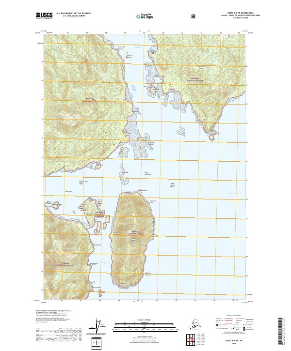
2021 Map of Craig B-5 NE
USGS Topo · Published 2021About this map
Portillo Channel serves as the central artery for this maritime landscape within the Tongass National Forest, separating the larger landmass of San Fernando Island from a cluster of smaller islands to the west. This 2021 survey details a complex archipelago where Spanish-named landmarks like Punta Santa Maria, Punta San Dionisio, and Punta San Salvador reflect the region's early exploratory history. The map covers a significant portion of the Prince of Wales-Hyder Census Area, emphasizing the intricate shoreline of Saint Ignace Island and the neighboring Santa Rita Island. Small, isolated features like Triste Island and Muerta Island are documented alongside navigational hazards such as Sucia Ledge and Rana Reef. The cartography illustrates a wilderness defined by its water-access geography, from the deep waters of Port Mayoral to the southern tip at Point Amargura.
Find a feature on this map
51 named features on this map. Tap any name to fly to it.
Don’t see what you’re looking for? This feature index may not catch every label — zoom into the map to look around manually.
Map Details
Editions of this 2021 Craig B-5 NE Map
This is the sole edition of this map. No revisions or reprints were ever made.
Other maps of this area

1948 · Craig B-5
USGS Topo · 1:63,360

1949 · Craig C-4
USGS Topo · 1:63,360

1949 · Craig B-4
USGS Topo · 1:63,360

1951 · Craig B-4
USGS Topo · 1:63,360

1951 · Craig C-4
USGS Topo · 1:63,360

1951 · Craig C-5
USGS Topo · 1:63,360

1957 · Craig
USGS Topo · 1:250,000

2000 · Craig B-5
USGS Topo · 1:63,360
2017 · Craig B-4 SW
USGS Topo · 1:25,000
2017 · Craig C-5 SW
USGS Topo · 1:25,000