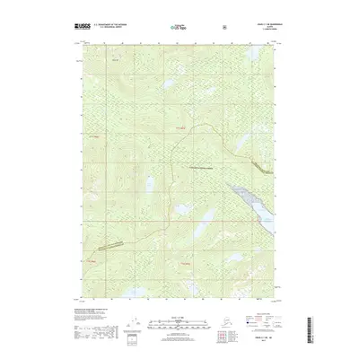
2017 Map of Craig C-1 NE
USGS Topo · Published 2017About this map
Tongass National Forest dominates this landscape in Southeast Alaska, defined by a series of significant freshwater bodies and coastal inlets. The terrain rises to South Mt, while drainage networks such as Black Bear Cr weave through the dense forest environment. The map shows the coastal reach of the Pacific Ocean at Helm Bay, where the shoreline transitions into the interior's complex hydrology. Scattered across the region are several named lakes, including Bear Lake, Bugge Lake, and Rainbow Lake, which serve as primary landmarks in this sparsely developed territory. This 2017 survey also delineates the jurisdictional boundary between Wrangell City and Borough and the Ketchikan Gateway Borough, illustrating the administrative divisions within the roadless Alaskan wilderness.
Find a feature on this map
15 named features on this map. Tap any name to fly to it.
Don’t see what you’re looking for? This feature index may not catch every label — zoom into the map to look around manually.
Map Details
Editions of this 2017 Craig C-1 NE Map
This is the sole edition of this map. No revisions or reprints were ever made.
Other maps of this area

1949 · Ketchikan C-6
USGS Topo · 1:63,360

1949 · Craig D-1
USGS Topo · 1:63,360

1950 · Craig C-1
USGS Topo · 1:63,360

1951 · Craig C-1
USGS Topo · 1:63,360

1951 · Craig D-1
USGS Topo · 1:63,360

1952 · Ketchikan
USGS Topo · 1:250,000

1952 · Ketchikan C-6
USGS Topo · 1:63,360

1952 · Ketchikan D-6
USGS Topo · 1:63,360

1953 · Ketchikan D-6
USGS Topo · 1:63,360

1955 · Ketchikan
USGS Topo · 1:250,000