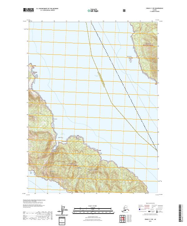
2021 Map of Craig C-1 SW
USGS Topo · Published 2021About this map
Clarence Strait dominates this coastal survey, serving as a primary maritime thoroughfare within the Alexander Archipelago. The land is defined by the dense wilderness of the Tongass National Forest, covering the rugged eastern shores of Prince of Wales Island and the jagged northern reaches of the Kasaan Peninsula. The topography rises steeply from the water's edge to landmarks like Mt Andrew, while the shoreline is carved into significant maritime features such as Lyman Anchorage and Kasaan Bay.
Find a feature on this map
19 named features on this map. Tap any name to fly to it.
Don’t see what you’re looking for? This feature index may not catch every label — zoom into the map to look around manually.
Map Details
Editions of this 2021 Craig C-1 SW Map
This is the sole edition of this map. No revisions or reprints were ever made.
Other maps of this area

1949 · Craig C-2
USGS Topo · 1:63,360

1949 · Craig B-2
USGS Topo · 1:63,360

1949 · Craig B-1
USGS Topo · 1:63,360

1950 · Craig B-1
USGS Topo · 1:63,360

1950 · Craig C-1
USGS Topo · 1:63,360

1951 · Craig B-2
USGS Topo · 1:63,360

1951 · Craig C-2
USGS Topo · 1:63,360

1951 · Craig C-1
USGS Topo · 1:63,360

1957 · Craig
USGS Topo · 1:250,000
1994 · Craig C-2
USGS Topo · 1:63,360