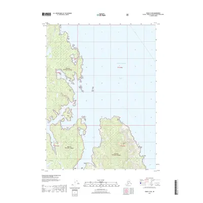
2017 Map of Craig C-2 NE
USGS Topo · Published 2017About this map
Tongass National Forest dominates this coastal landscape along the Clarence Strait in Southeast Alaska. The geography is defined by a series of prominent maritime landforms, including the high elevation of Tolstoi Mtn and the strategic positioning of Thorne Head overlooking the surrounding waters. Significant hydrological features such as Salamander Lake and Loon Lake are tucked within the dense coastal forest, while the jagged shoreline is broken by Forss Cove and the wide mouth of Tolstoi Bay. Transportation in this part of Prince of Wales is sparse, centered on the Kasaan Road which skirts the southern edge of the quadrangle. This 2017 edition provides a detailed look at the interface between the Pacific Ocean and the Alaskan wilderness, highlighting landmarks like Tolstoi Island and Tolstoi Point that serve as navigational aids for those traversing the strait.
Find a feature on this map
13 named features on this map. Tap any name to fly to it.
Don’t see what you’re looking for? This feature index may not catch every label — zoom into the map to look around manually.
Map Details
Editions of this 2017 Craig C-2 NE Map
This is the sole edition of this map. No revisions or reprints were ever made.
Other maps of this area

1949 · Craig C-2
USGS Topo · 1:63,360

1949 · Craig D-2
USGS Topo · 1:63,360

1949 · Craig D-1
USGS Topo · 1:63,360

1950 · Craig C-1
USGS Topo · 1:63,360

1951 · Craig D-2
USGS Topo · 1:63,360

1951 · Craig C-2
USGS Topo · 1:63,360

1951 · Craig C-1
USGS Topo · 1:63,360

1951 · Craig D-1
USGS Topo · 1:63,360

1957 · Craig
USGS Topo · 1:250,000
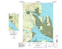
1994 · Craig C-2
USGS Topo · 1:63,360