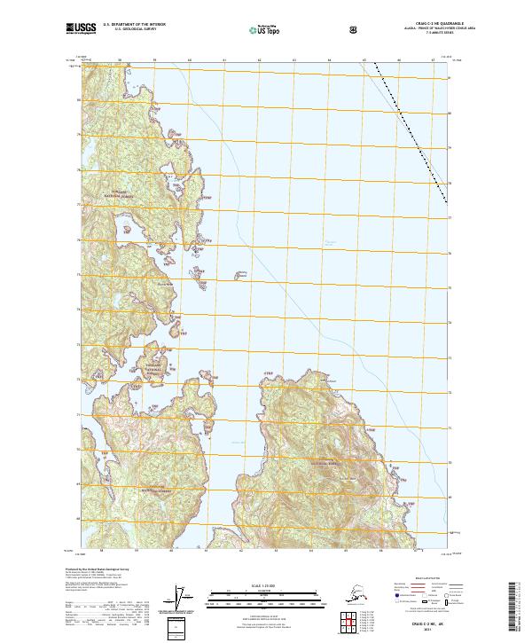
2021 Map of Craig C-2 NE
USGS Topo · Published 2021About this map
Clarence Strait defines the eastern shoreline of this coastal portion of Tongass National Forest, where the terrain of Prince of Wales Island meets the sea. The landscape is dominated by steep coastal elevations, most notably at Tolstoi Mtn, which rises above the protected waters of Tolstoi Bay. To the north, the coastline is broken by prominent features such as Thorne Head and Tolstoi Point, while the small outcrop of Tolstoi Island sits offshore. This survey captures a wild, nearly unsettled stretch of the Alexander Archipelago, showing the intricate relationship between the deep water inlets and the heavily forested, mountainous interior during the early 21st century.
Find a feature on this map
12 named features on this map. Tap any name to fly to it.
Don’t see what you’re looking for? This feature index may not catch every label — zoom into the map to look around manually.
Map Details
Editions of this 2021 Craig C-2 NE Map
This is the sole edition of this map. No revisions or reprints were ever made.
Other maps of this area

1949 · Craig C-2
USGS Topo · 1:63,360

1949 · Craig D-2
USGS Topo · 1:63,360

1949 · Craig D-1
USGS Topo · 1:63,360

1950 · Craig C-1
USGS Topo · 1:63,360

1951 · Craig D-2
USGS Topo · 1:63,360

1951 · Craig C-2
USGS Topo · 1:63,360

1951 · Craig C-1
USGS Topo · 1:63,360

1951 · Craig D-1
USGS Topo · 1:63,360

1957 · Craig
USGS Topo · 1:250,000
1994 · Craig C-2
USGS Topo · 1:63,360