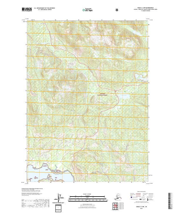
2021 Map of Craig C-3 NW
USGS Topo · Published 2021About this map
Prince of Wales Island is home to a dense network of forest service roads and trails that carve through the wilderness of Tongass National Forest. This interior portion of the island is defined by steep ridges like Shaheen and the deep drainage of Staney Creek. The landscape reflects a specialized infrastructure for timber access and wilderness management, evidenced by the prevalence of named routes like the North Prince of Wales road and the Ten By Ten trail system. Recreation points are centered around water bodies such as Control Lake and Toms Lake, with more remote landmarks including Wolf Bass Falls to the south. The mapping of spurs like Saddle Spur and the Camp Meadow area indicates a terrain that has been thoroughly surveyed for both resource management and backcountry navigation.
Find a feature on this map
29 named features on this map. Tap any name to fly to it.
Don’t see what you’re looking for? This feature index may not catch every label — zoom into the map to look around manually.
Map Details
Editions of this 2021 Craig C-3 NW Map
This is the sole edition of this map. No revisions or reprints were ever made.
Other maps of this area

1949 · Craig D-3
USGS Topo · 1:63,360

1949 · Craig D-4
USGS Topo · 1:63,360

1949 · Craig C-3
USGS Topo · 1:63,360

1949 · Craig C-4
USGS Topo · 1:63,360

1950 · Craig D-3
USGS Topo · 1:63,360

1951 · Craig C-3
USGS Topo · 1:63,360

1951 · Craig C-4
USGS Topo · 1:63,360

1951 · Craig D-4
USGS Topo · 1:63,360

1957 · Craig
USGS Topo · 1:250,000
1994 · Craig D-3
USGS Topo · 1:63,360