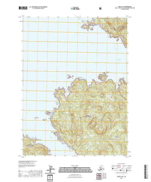
2021 Map of Craig C-5 SE
USGS Topo · Published 2021About this map
San Fernando Island dominates this coastal survey of the Alexander Archipelago, revealing a complex shoreline within the Tongass National Forest. The landscape is defined by its maritime geography, where narrow passages like Portillo Channel and San Christoval Channel separate the primary landmass from numerous smaller outcrops such as Animas Island and the Blanquizal Islands. The map detail follows the intricate indentations of the coast, noting features like Garcia Cove and Aguirre Bay, which provide natural shelters along the Pacific edge. This record of the Prince of Wales-Hyder Census Area highlights the topographical variety of the island, from the low-lying Abreojo Rocks to named points such as Point Santa Lucia and Point San Pasqual that served as critical navigation markers for vessels moving through these northern waters.
Find a feature on this map
31 named features on this map. Tap any name to fly to it.
Don’t see what you’re looking for? This feature index may not catch every label — zoom into the map to look around manually.
Map Details
Editions of this 2021 Craig C-5 SE Map
This is the sole edition of this map. No revisions or reprints were ever made.
Other maps of this area

1948 · Craig B-5
USGS Topo · 1:63,360

1949 · Craig C-4
USGS Topo · 1:63,360

1949 · Craig B-4
USGS Topo · 1:63,360

1951 · Craig B-4
USGS Topo · 1:63,360

1951 · Craig C-4
USGS Topo · 1:63,360

1951 · Craig C-5
USGS Topo · 1:63,360

1957 · Craig
USGS Topo · 1:250,000

2000 · Craig B-5
USGS Topo · 1:63,360
2017 · Craig C-5 NW
USGS Topo · 1:25,000
2017 · Craig C-5 SW
USGS Topo · 1:25,000