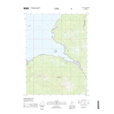
2017 Map of Craig D-1 SE
USGS Topo · Published 2017About this map
Cleveland Peninsula dominates the eastern portion of this coastal survey, where the dense timber of the Tongass National Forest meets the intricate waterways of the Alexander Archipelago. The landscape is defined by the significant rise of Mt Burnett, which serves as a central landmark for the surrounding wilderness. To the west, the Pacific Ocean pushes into the shoreline through sheltered features like Vixen Harbor and the larger Vixen Inlet, protected by Vixen Point. This terrain reflects the complex maritime geography of the Wrangell region, where small freshwater systems like Cannery Cr drain the steep topography into the salt water. The presence of Sunshine Island at the mouth of the inlet underscores the navigational challenges and natural protection inherent in these glacial-carved coastal stretches.
Find a feature on this map
15 named features on this map. Tap any name to fly to it.
Don’t see what you’re looking for? This feature index may not catch every label — zoom into the map to look around manually.
Map Details
Editions of this 2017 Craig D-1 SE Map
This is the sole edition of this map. No revisions or reprints were ever made.
Other maps of this area

1949 · Ketchikan C-6
USGS Topo · 1:63,360

1949 · Craig D-1
USGS Topo · 1:63,360

1950 · Craig C-1
USGS Topo · 1:63,360

1951 · Craig C-1
USGS Topo · 1:63,360

1951 · Craig D-1
USGS Topo · 1:63,360

1952 · Ketchikan
USGS Topo · 1:250,000

1952 · Ketchikan C-6
USGS Topo · 1:63,360

1952 · Ketchikan D-6
USGS Topo · 1:63,360

1953 · Ketchikan D-6
USGS Topo · 1:63,360

1955 · Ketchikan
USGS Topo · 1:250,000