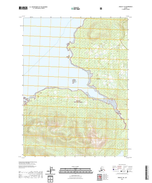
2021 Map of Craig D-1 SE
USGS Topo · Published 2021About this map
The massive Mt Burnett dominates the southern reaches of this maritime landscape, its high elevations rising sharply above the complex shoreline of the Cleveland Peninsula. This modern survey documents a segment of the Tongass National Forest where the deep waters of Vixen Inlet cut into the timbered slopes. Along the coast, small geographical features like Sunshine Island and Vixen Point mark the transition from the protected waters of the inlet to the broader coastal expanse. The drainage of Cannery Cr flows into the inlet, hinting at the historical significance of these waterways for the region's salmon-based industrial past. Positioned on the boundary between the Wrangell-City and Borough and the Ketchikan Gateway Borough, the map illustrates a wilderness area where contemporary administrative lines meet an ancient, glacial-carved terrain.
Find a feature on this map
13 named features on this map. Tap any name to fly to it.
Don’t see what you’re looking for? This feature index may not catch every label — zoom into the map to look around manually.
Map Details
Editions of this 2021 Craig D-1 SE Map
This is the sole edition of this map. No revisions or reprints were ever made.
Other maps of this area

1949 · Ketchikan C-6
USGS Topo · 1:63,360

1949 · Craig D-1
USGS Topo · 1:63,360

1950 · Craig C-1
USGS Topo · 1:63,360

1951 · Craig C-1
USGS Topo · 1:63,360

1951 · Craig D-1
USGS Topo · 1:63,360

1952 · Ketchikan
USGS Topo · 1:250,000

1952 · Ketchikan C-6
USGS Topo · 1:63,360

1952 · Ketchikan D-6
USGS Topo · 1:63,360

1953 · Ketchikan D-6
USGS Topo · 1:63,360

1955 · Ketchikan
USGS Topo · 1:250,000