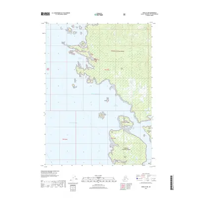
2017 Map of Craig D-2 NE
USGS Topo · Published 2017About this map
Etolin Island dominates this southeastern Alaskan coastal landscape, where the dense timber of the Tongass National Forest meets the intricate waterways of the Alexander Archipelago. The geography is defined by a series of sheltered harborages, most notably McHenry Anchorage and Dewey Anchorage, which provide refuge from the open waters of the Gulf of Alaska. These natural harbors serve as critical points for maritime navigation and small-craft sheltering among the scattered landmasses such as Onslow Island and Mabel Island. Inland, the terrain is characterized by steep elevation changes and small bodies of fresh water like Krogh Lake. This coastal area shows a classic glacial-carved shoreline with numerous small outcroppings like Quartz Rock and Split Island that dot the passage between the larger islands.
Find a feature on this map
25 named features on this map. Tap any name to fly to it.
Don’t see what you’re looking for? This feature index may not catch every label — zoom into the map to look around manually.
Map Details
Editions of this 2017 Craig D-2 NE Map
This is the sole edition of this map. No revisions or reprints were ever made.
Other maps of this area

1948 · Petersburg A-1
USGS Topo · 1:63,360

1948 · Petersburg A-2
USGS Topo · 1:63,360

1949 · Craig D-2
USGS Topo · 1:63,360

1949 · Craig D-1
USGS Topo · 1:63,360

1951 · Craig D-2
USGS Topo · 1:63,360

1951 · Craig D-1
USGS Topo · 1:63,360

1951 · Petersburg A-1
USGS Topo · 1:63,360

1952 · Petersburg
USGS Topo · 1:250,000

1953 · Petersburg A-2
USGS Topo · 1:63,360

1957 · Craig
USGS Topo · 1:250,000