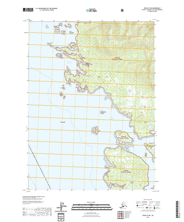
2021 Map of Craig D-2 NE
USGS Topo · Published 2021About this map
Tongass National Forest dominates this coastal region of Southeast Alaska, where a labyrinth of islands and waterways defines the maritime landscape. This survey of the Craig D-2 NE quadrangle highlights the complex shoreline of Etolin Island and its relationship to the surrounding archipelago. Navigational landmarks such as McHenry Anchorage and Dewey Anchorage provide critical shelter for vessels moving through these waters, which are dotted with smaller landmasses like Mabel Island, Carlton Island, and Onslow Island. The terrain is characterized by steep, forested slopes rising directly from the sea, with named points of interest such as Kelp Point and Gull Point marking the irregular coast. The presence of Wrangell administrative boundaries and township lines such as t68s r84e illustrates the modern cadastral framework overlaid upon this remote wilderness, serving as an essential reference for maritime navigation and land management.
Find a feature on this map
22 named features on this map. Tap any name to fly to it.
Don’t see what you’re looking for? This feature index may not catch every label — zoom into the map to look around manually.
Map Details
Editions of this 2021 Craig D-2 NE Map
This is the sole edition of this map. No revisions or reprints were ever made.
Other maps of this area

1948 · Petersburg A-1
USGS Topo · 1:63,360

1948 · Petersburg A-2
USGS Topo · 1:63,360

1949 · Craig D-2
USGS Topo · 1:63,360

1949 · Craig D-1
USGS Topo · 1:63,360

1951 · Craig D-2
USGS Topo · 1:63,360

1951 · Craig D-1
USGS Topo · 1:63,360

1951 · Petersburg A-1
USGS Topo · 1:63,360

1952 · Petersburg
USGS Topo · 1:250,000

1953 · Petersburg A-2
USGS Topo · 1:63,360

1957 · Craig
USGS Topo · 1:250,000