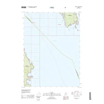
2017 Map of Craig D-2 SE
USGS Topo · Published 2017About this map
Tongass National Forest dominates this coastal landscape where the Gulf of Alaska meets the Pacific Ocean. The map documents a rugged maritime interface along the boundary between the Wrangell Borough Prince of Wales-Hyder Census Area. Distinctive coastal landmarks such as Ernest Point and Narrow Point define the intricate shoreline, illustrating the complex geography of these protected Alaskan wilderness lands. This 2017 survey serves as a precise record of the shoreline and maritime boundaries within the TNF system during the early twenty-first century, providing essential geographic data for an area where land and sea are inextricably linked.
Find a feature on this map
10 named features on this map. Tap any name to fly to it.
Don’t see what you’re looking for? This feature index may not catch every label — zoom into the map to look around manually.
Map Details
Editions of this 2017 Craig D-2 SE Map
This is the sole edition of this map. No revisions or reprints were ever made.
Other maps of this area

1949 · Craig C-2
USGS Topo · 1:63,360

1949 · Craig D-2
USGS Topo · 1:63,360

1949 · Craig D-1
USGS Topo · 1:63,360

1950 · Craig C-1
USGS Topo · 1:63,360

1951 · Craig D-2
USGS Topo · 1:63,360

1951 · Craig C-2
USGS Topo · 1:63,360

1951 · Craig C-1
USGS Topo · 1:63,360

1951 · Craig D-1
USGS Topo · 1:63,360

1957 · Craig
USGS Topo · 1:250,000
1994 · Craig C-2
USGS Topo · 1:63,360