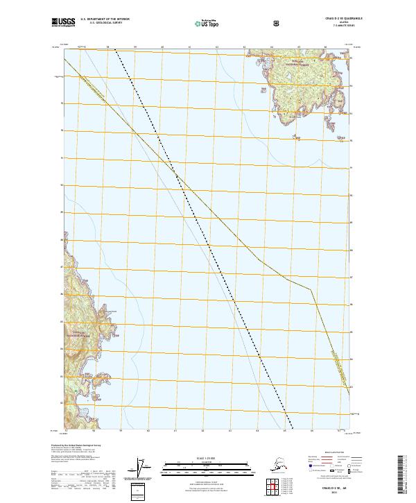
2021 Map of Craig D-2 SE
USGS Topo · Published 2021About this map
Tongass National Forest dominates this coastal landscape where the maritime boundary separates Wrangell City and Borough from the Prince of Wales-Hyder Census Area. The map focuses on two distinct shoreline reaches separated by open water, highlighting the intricate relationship between the land and the sea in Southeast Alaska. Ernest Point marks a prominent projection on the northern landmass, while Narrow Point defines a sharp turn in the coastline to the southwest. These points served as critical navigational landmarks for mariners and coastal inhabitants long before modern surveying. The interior of these landmasses is largely designated as part of the TNF, indicating a landscape maintained in its natural state, governed by the federal forest system and defined by the township and range grids of t69s r84e, t69s r85e, and t70s r84e.
Find a feature on this map
8 named features on this map. Tap any name to fly to it.
Don’t see what you’re looking for? This feature index may not catch every label — zoom into the map to look around manually.
Map Details
Editions of this 2021 Craig D-2 SE Map
This is the sole edition of this map. No revisions or reprints were ever made.
Other maps of this area

1949 · Craig C-2
USGS Topo · 1:63,360

1949 · Craig D-2
USGS Topo · 1:63,360

1949 · Craig D-1
USGS Topo · 1:63,360

1950 · Craig C-1
USGS Topo · 1:63,360

1951 · Craig D-2
USGS Topo · 1:63,360

1951 · Craig C-2
USGS Topo · 1:63,360

1951 · Craig C-1
USGS Topo · 1:63,360

1951 · Craig D-1
USGS Topo · 1:63,360

1957 · Craig
USGS Topo · 1:250,000
1994 · Craig C-2
USGS Topo · 1:63,360