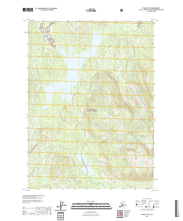
2021 Map of Craig D-3 NW
USGS Topo · Published 2021About this map
Sweetwater Lake dominates this wilderness landscape within the Tongass National Forest, serving as a central hub for the intricate network of waterways and trails on Prince of Wales Island. The map documents the Honker Divide Canoe Route Trl, a vital passage connecting Hatchery Creek to the surrounding lake systems. This inland corridor is defined by rugged elevation changes at Log Jam Ridge and the swift waters of Sockeye Falls. A dense web of forest service roads and trails, such as the Coffman Cove Loop and Hatchery Creek Trl, illustrates the modern infrastructure used for forest management and backcountry access. Along the northern coast, the tidal interface at Gold and Galligan Lagoon and Galligan Lagoon Up Chuck highlights the complex coastal geography of the Alexander Archipelago.
Find a feature on this map
46 named features on this map. Tap any name to fly to it.
Don’t see what you’re looking for? This feature index may not catch every label — zoom into the map to look around manually.
Map Details
Editions of this 2021 Craig D-3 NW Map
This is the sole edition of this map. No revisions or reprints were ever made.
Other maps of this area

1949 · Craig D-3
USGS Topo · 1:63,360

1949 · Petersburg A-3
USGS Topo · 1:63,360

1949 · Craig D-4
USGS Topo · 1:63,360

1949 · Petersburg A-4
USGS Topo · 1:63,360

1950 · Craig D-3
USGS Topo · 1:63,360

1951 · Craig D-4
USGS Topo · 1:63,360

1952 · Petersburg
USGS Topo · 1:250,000

1953 · Petersburg A-4
USGS Topo · 1:63,360

1953 · Petersburg A-3
USGS Topo · 1:63,360

1957 · Craig
USGS Topo · 1:250,000