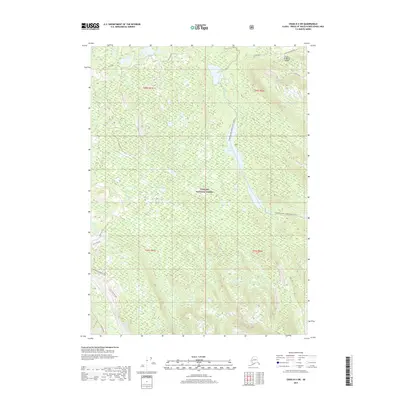
2017 Map of Craig D-3 SW
USGS Topo · Published 2017About this map
Prince of Wales Island within the Tongass National Forest is depicted here in a landscape defined by waterway networks and timber access. The Honker Divide Canoe Route (Water) flows through the central corridor, passing through Lake Galea as it follows the course of Hatchery Cr. This waterway represents a vital transit artery in a region otherwise dominated by complex topography and specialized forest service roads.
Find a feature on this map
20 named features on this map. Tap any name to fly to it.
Don’t see what you’re looking for? This feature index may not catch every label — zoom into the map to look around manually.
Map Details
Editions of this 2017 Craig D-3 SW Map
This is the sole edition of this map. No revisions or reprints were ever made.
Other maps of this area

1949 · Craig D-3
USGS Topo · 1:63,360

1949 · Craig D-4
USGS Topo · 1:63,360

1949 · Craig C-3
USGS Topo · 1:63,360

1949 · Craig C-4
USGS Topo · 1:63,360

1950 · Craig D-3
USGS Topo · 1:63,360

1951 · Craig C-3
USGS Topo · 1:63,360

1951 · Craig C-4
USGS Topo · 1:63,360

1951 · Craig D-4
USGS Topo · 1:63,360

1957 · Craig
USGS Topo · 1:250,000
1994 · Craig D-3
USGS Topo · 1:63,360