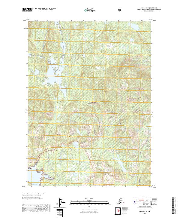
2021 Map of Craig D-4 NE
USGS Topo · Published 2021About this map
Tongass National Forest dominates this landscape on Prince of Wales Island, revealing a complex network of timber and access roads that define the region's modern character. Along the southern coast at Naukati Bay, the map details the intricate shoreline near Gutch Cove and Rock Point. Further inland, the presence of the Sarkar Canoe Route Trl and the Fish City Trl points to the area's significance for navigation and wilderness access. This survey provides a distinct view of the land's infrastructure, showing the many "Spur" and "Tie" roads such as the Coffman Tie and Log Spur One that weave through the forest. Named water features like Rabbit Ears Lake, Pie Pan Lake, and Strange Falls highlight the varied hydrology of this coastal environment.
Find a feature on this map
40 named features on this map. Tap any name to fly to it.
Don’t see what you’re looking for? This feature index may not catch every label — zoom into the map to look around manually.
Map Details
Editions of this 2021 Craig D-4 NE Map
This is the sole edition of this map. No revisions or reprints were ever made.
Other maps of this area

1949 · Craig D-3
USGS Topo · 1:63,360

1949 · Petersburg A-3
USGS Topo · 1:63,360

1949 · Craig D-4
USGS Topo · 1:63,360

1949 · Petersburg A-4
USGS Topo · 1:63,360

1950 · Craig D-3
USGS Topo · 1:63,360

1951 · Craig D-4
USGS Topo · 1:63,360

1952 · Petersburg
USGS Topo · 1:250,000

1953 · Petersburg A-4
USGS Topo · 1:63,360

1953 · Petersburg A-3
USGS Topo · 1:63,360

1957 · Craig
USGS Topo · 1:250,000