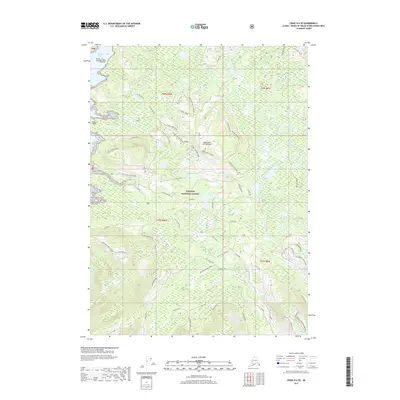
2017 Map of Craig D-4 SE
USGS Topo · Published 2017About this map
Naukati Bay and the islands of the Alexander Archipelago anchor the northwestern edge of this landscape within the Tongass National Forest. The map documents a dense network of forest service roads and timber management infrastructure, including Coffman Tie and the winding Fish Road. This logistical framework suggests the industrial scale of 21st-century timber operations across Prince of Wales Island, contrasting with the wilderness character of the terrain.
Find a feature on this map
66 named features on this map. Tap any name to fly to it.
Don’t see what you’re looking for? This feature index may not catch every label — zoom into the map to look around manually.
Map Details
Editions of this 2017 Craig D-4 SE Map
This is the sole edition of this map. No revisions or reprints were ever made.
Other maps of this area

1949 · Craig D-3
USGS Topo · 1:63,360

1949 · Craig D-4
USGS Topo · 1:63,360

1949 · Craig C-3
USGS Topo · 1:63,360

1949 · Craig C-4
USGS Topo · 1:63,360

1950 · Craig D-3
USGS Topo · 1:63,360

1951 · Craig C-3
USGS Topo · 1:63,360

1951 · Craig C-4
USGS Topo · 1:63,360

1951 · Craig D-4
USGS Topo · 1:63,360

1957 · Craig
USGS Topo · 1:250,000
1994 · Craig D-3
USGS Topo · 1:63,360