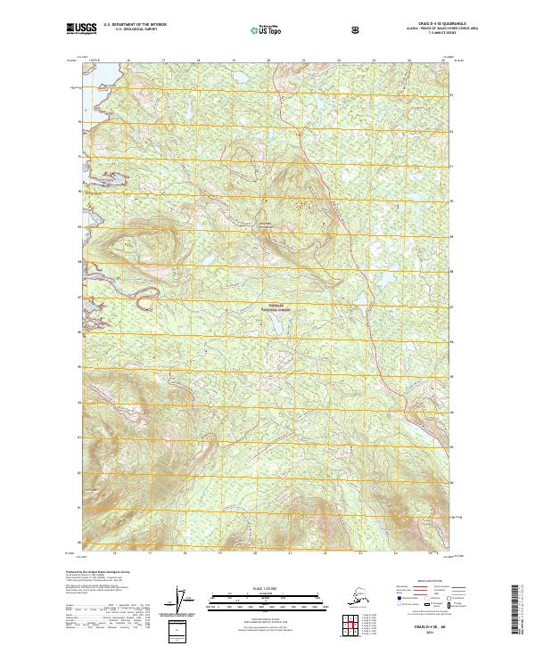
2021 Map of Craig D-4 SE
USGS Topo · Published 2021About this map
The Alexander Archipelago coastline and the inland reaches of Tuxekan Passage define this section of the Tongass National Forest. Dominated by a complex network of logging roads and trails, the landscape is centered on the drainage of Staney Creek, where the Staney Creek Campground and Silver Salmon Falls indicate a transition from active timber management to recreational use. Higher elevations are marked by distinctive peaks such as Twin Mtn and Staney Knob, while the lowlands are punctuated by significant water bodies including Clover Lake and Upper Goose Lake. The intricate system of spur roads, such as 48-Mile Spur and Plateau Spur, illustrates the heavy industrial footprint of the 21st-century timber industry within these federal lands, providing a detailed record of the access routes carved into the Prince of Wales Island interior.
Find a feature on this map
69 named features on this map. Tap any name to fly to it.
Don’t see what you’re looking for? This feature index may not catch every label — zoom into the map to look around manually.
Map Details
Editions of this 2021 Craig D-4 SE Map
This is the sole edition of this map. No revisions or reprints were ever made.
Other maps of this area

1949 · Craig D-3
USGS Topo · 1:63,360

1949 · Craig D-4
USGS Topo · 1:63,360

1949 · Craig C-3
USGS Topo · 1:63,360

1949 · Craig C-4
USGS Topo · 1:63,360

1950 · Craig D-3
USGS Topo · 1:63,360

1951 · Craig C-3
USGS Topo · 1:63,360

1951 · Craig C-4
USGS Topo · 1:63,360

1951 · Craig D-4
USGS Topo · 1:63,360

1957 · Craig
USGS Topo · 1:250,000
1994 · Craig D-3
USGS Topo · 1:63,360