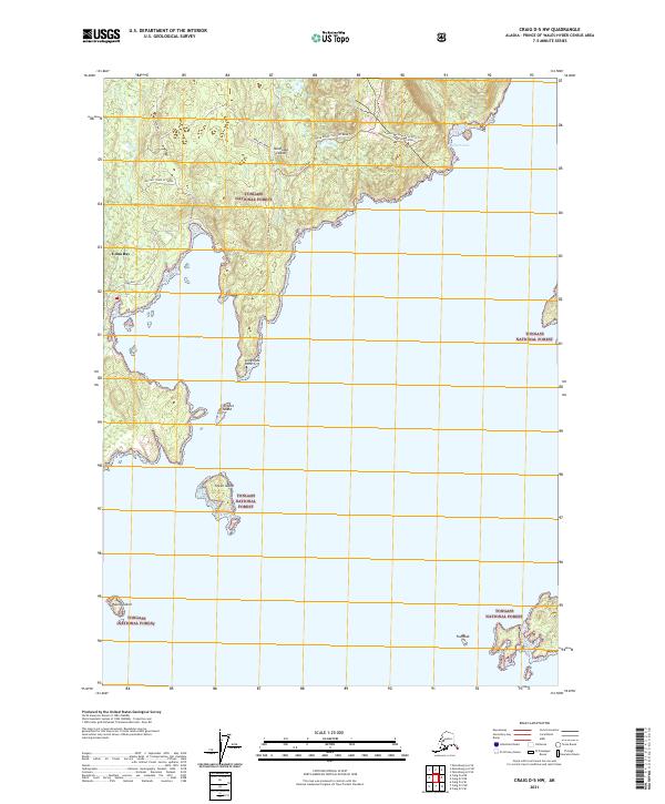
2021 Map of Craig D-5 NW
USGS Topo · Published 2021About this map
Kosciuszko Island and its jagged coastline within the Tongass National Forest define this 2021 study. The settlement of Edna Bay sits along its namesake inlet, connected to the interior via the Edna Bay Bypass and Mid East Charley Creek road. This landscape reflects the modern intersection of wilderness management and isolated coastal habitation, where timber roads like the Three-Kings Spur A 1525225 Trl and Three Knobs 1525200 Road Trl navigate around elevations like Three Knobs. The maritime geography is particularly detailed, showing a complex network of islets and navigation points including Limestone Point, Entrance Island, and Green Island, which guard the approaches to the local harbor. This survey provides a precise account of the existing infrastructure and topography of Prince of Wales-Hyder Census Area in the early 2020s.
Find a feature on this map
22 named features on this map. Tap any name to fly to it.
Don’t see what you’re looking for? This feature index may not catch every label — zoom into the map to look around manually.
Map Details
Editions of this 2021 Craig D-5 NW Map
This is the sole edition of this map. No revisions or reprints were ever made.
Other maps of this area

1948 · Petersburg A-6
USGS Topo · 1:63,360

1949 · Petersburg A-5
USGS Topo · 1:63,360

1951 · Craig D-6
USGS Topo · 1:63,360

1951 · Craig D-5
USGS Topo · 1:63,360

1951 · Petersburg A-6
USGS Topo · 1:63,360

1952 · Petersburg
USGS Topo · 1:250,000

1953 · Petersburg A-5
USGS Topo · 1:63,360

1957 · Craig
USGS Topo · 1:250,000

1960 · Petersburg
USGS Topo · 1:250,000
1995 · Petersburg A-5
USGS Topo · 1:63,360