
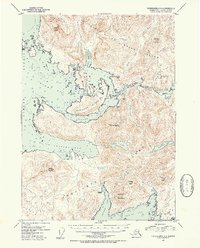
1953 Map of Petersburg A-5
USGS Topo · Published 1954About this map
Prince of Wales Island and the northern reaches of Kosciusko Island are defined by a complex network of waterways and early coastal outposts in the mid-1950s. The landscape is marked by several significant deserted settlements, including Shakan (Aband) on Hamilton Island and Calder (Aband) near Calder Bay, indicating a shifting pattern of industry or residence along the Sumner Strait. These sites, along with Holbrook (Aband) on the shores of Davidson Inlet, reflect the transient nature of early twentieth-century maritime and resource-based economies in the Alexander Archipelago.
Find a feature on this map
37 named features on this map. Tap any name to fly to it.
Don’t see what you’re looking for? This feature index may not catch every label — zoom into the map to look around manually.
Map Details
Editions of this 1953 Petersburg A-5 Map
2 editions found
Other maps of this area

1948 · Petersburg A-6
USGS Topo · 1:63,360

1948 · Petersburg B-6
USGS Topo · 1:63,360

1949 · Petersburg B-5
USGS Topo · 1:63,360

1949 · Craig D-4
USGS Topo · 1:63,360

1949 · Petersburg A-5
USGS Topo · 1:63,360

1949 · Petersburg A-4
USGS Topo · 1:63,360

1949 · Petersburg B-4
USGS Topo · 1:63,360

1951 · Craig D-6
USGS Topo · 1:63,360

1951 · Craig D-5
USGS Topo · 1:63,360

1951 · Craig D-4
USGS Topo · 1:63,360