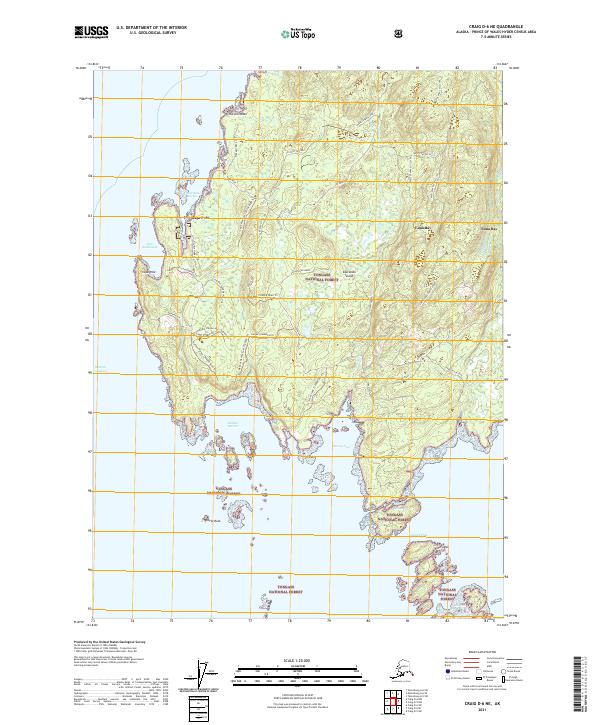
2021 Map of Craig D-6 NE
USGS Topo · Published 2021About this map
Kosciusko Island dominates this coastal survey, where the rugged maritime geography of the Tongass National Forest meets the intricate waterways of Southeast Alaska. The map centers on the small settlements of Cape Pole and Edna Bay, illustrating the localized road networks that serve these remote outposts. Much of the infrastructure is tied to the shoreline, with Pole Anchorage and Shermans Harbor providing essential maritime access. To the south, the terrain descends from the 200 Foot Plateau toward a series of sheltered inlets, including Halibut Harbor and Survey Cove. The map documents a labyrinth of forest service roads and trails like the Dog Leg and Survey Edna North Loop, which navigate the elevation changes between the West Central Hills and the coast, reflecting the ongoing intersection of timber management and coastal settlement in this part of the Prince of Wales-Hyder Census Area.
Find a feature on this map
44 named features on this map. Tap any name to fly to it.
Don’t see what you’re looking for? This feature index may not catch every label — zoom into the map to look around manually.
Map Details
Editions of this 2021 Craig D-6 NE Map
This is the sole edition of this map. No revisions or reprints were ever made.
Other maps of this area

1948 · Petersburg A-6
USGS Topo · 1:63,360

1949 · Petersburg A-5
USGS Topo · 1:63,360

1951 · Craig D-6
USGS Topo · 1:63,360

1951 · Craig D-5
USGS Topo · 1:63,360

1951 · Petersburg A-6
USGS Topo · 1:63,360

1952 · Petersburg
USGS Topo · 1:250,000

1953 · Petersburg A-5
USGS Topo · 1:63,360

1957 · Craig
USGS Topo · 1:250,000

1960 · Petersburg
USGS Topo · 1:250,000
1995 · Petersburg A-5
USGS Topo · 1:63,360