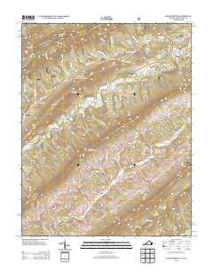
2013 Map of Craig Springs
USGS Topo · Published 2013About this map
Craig Springs serves as a focal point in this mountainous region of the Virginia-West Virginia borderlands, where the landscape is defined by long, parallel ridges and the winding courses of Sinking Creek and Johns Creek. The map documents a rural network of small settlements such as Simmonsville and Valley Mill, alongside local landmarks like Blue Healing Springs. These names suggest a history tied to the area's natural mineral waters and early milling industry. High elevations including Arnolds Knob and Sevenmile Mountain overlook a series of narrow valleys and hollows, such as Wide Hollow and Tucker Hollow, reflecting the typical Appalachian topography of the early 21st century. The density of named ridges like Tanyard Ridge and Henry Soap Ridge indicates a landscape deeply integrated with local identity and family-named landform history.
Find a feature on this map
54 named features on this map. Tap any name to fly to it.
Don’t see what you’re looking for? This feature index may not catch every label — zoom into the map to look around manually.
Map Details
Editions of this 2013 Craig Springs Map
This is the sole edition of this map. No revisions or reprints were ever made.
Other maps of this area

1887 · Lewisburg
USGS Topo · 1:125,000

1890 · Christiansburg
USGS Topo · 1:125,000

1891 · Lewisburg
USGS Topo · 1:125,000

1921 · Ronceverte
USGS Topo · 1:48,000

1923 · Ronceverte
USGS Topo · 1:62,500

1923 · Waiteville
USGS Topo · 1:62,500

1929 · Salem
USGS Topo · 1:48,000

1931 · Waiteville
USGS Topo · 1:48,000

1932 · Salem
USGS Topo · 1:62,500

1944 · Waiteville
USGS Topo · 1:62,500