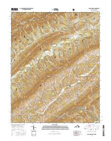
2016 Map of Craig Springs
USGS Topo · Published 2016About this map
Potts Mountain and Johns Creek Mtn dominate the landscape of this region along the Virginia and West Virginia border, where the Jefferson National Forest spans much of the high ground. The drainage patterns of Sinking Creek and Johns Creek define the habitable valleys, which are punctuated by small rural settlements like Simmonsville, Valley Mill, and Craig Springs. This area showcases a classic Appalachian pattern of ridge-and-valley agriculture and timber land, with the Appalachian National Scenic Trail traversing Sinking Creek Mtn in the southeast. Genealogists and local historians may find the County Farm Cem and Ross Cem of particular interest, as they sit near the traditional travel corridors of State Rte 658 and State Rte 632. Names like Arnolds Knob, Henry Soap Ridge, and Wildcat Ridge reflect a long history of local land naming conventions tied to prominent families and the physical environment.
Find a feature on this map
70 named features on this map. Tap any name to fly to it.
Don’t see what you’re looking for? This feature index may not catch every label — zoom into the map to look around manually.
Map Details
Editions of this 2016 Craig Springs Map
This is the sole edition of this map. No revisions or reprints were ever made.
Other maps of this area

1887 · Lewisburg
USGS Topo · 1:125,000

1890 · Christiansburg
USGS Topo · 1:125,000

1891 · Lewisburg
USGS Topo · 1:125,000

1921 · Ronceverte
USGS Topo · 1:48,000

1923 · Ronceverte
USGS Topo · 1:62,500

1923 · Waiteville
USGS Topo · 1:62,500

1929 · Salem
USGS Topo · 1:48,000

1931 · Waiteville
USGS Topo · 1:48,000

1932 · Salem
USGS Topo · 1:62,500

1944 · Waiteville
USGS Topo · 1:62,500