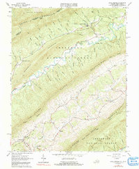
1965 Map of Craig Springs
USGS Topo · Published 1991About this map
Potts Mountain and Sevenmile Mountain dominate this mid-century view of the Virginia and West Virginia borderlands. The landscape is defined by the extensive reaches of the Jefferson National Forest, where steep ridges and narrow hollows dictate the pattern of settlement. Local communities like Simmonsville and Craig Springs are positioned along the primary valley floors, supported by a network of small streams including Johns Creek and Sinking Creek.
Find a feature on this map
62 named features on this map. Tap any name to fly to it.
Don’t see what you’re looking for? This feature index may not catch every label — zoom into the map to look around manually.
Map Details
Editions of this 1965 Craig Springs Map
2 editions found
Other maps of this area

1887 · Lewisburg
USGS Topo · 1:125,000

1890 · Christiansburg
USGS Topo · 1:125,000

1891 · Lewisburg
USGS Topo · 1:125,000

1921 · Ronceverte
USGS Topo · 1:48,000

1923 · Ronceverte
USGS Topo · 1:62,500

1923 · Waiteville
USGS Topo · 1:62,500

1929 · Salem
USGS Topo · 1:48,000

1931 · Waiteville
USGS Topo · 1:48,000

1932 · Salem
USGS Topo · 1:62,500

1944 · Waiteville
USGS Topo · 1:62,500