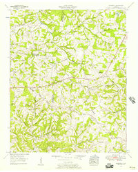
1953 Map of Craigfield
USGS Topo · Published 1957About this map
The Tennessee Valley Divide snakes across this landscape, defining the watershed between the Cumberland and Tennessee river systems during the early 1950s. This rural crossroads of Dickson, Williamson, and Hickman counties is characterized by a dense network of small family burial grounds and country churches that reflect generations of local settlement. Clusters of community life are centered around Craigfield and the Lampley Store, while educational hubs like the Tidwell Sch and Triangle Sch served the surrounding hollows. The terrain is deeply incised by waterways such as Big Turnbull Creek and South Harpeth Creek, with many place names like Mangrum Hollow and Caney Hollow preserving the names of early resident families. This 1947 aerial photography-based study captures the transition of Fairview and its environs before modern suburban expansion altered the historical agricultural and timber patterns of Middle Tennessee.
Find a feature on this map
76 named features on this map. Tap any name to fly to it.
Don’t see what you’re looking for? This feature index may not catch every label — zoom into the map to look around manually.
Map Details
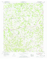
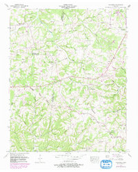
Editions of this 1953 Craigfield Map
3 editions found
Other maps of this area

1901 · Colombia
USGS Topo · 1:125,000

1930 · White Bluff
USGS Topo · 1:62,500

1933 · White Bluff
USGS Topo · 1:62,500

1936 · Primm
USGS Topo · 1:24,000

1936 · Littlelot
USGS Topo · 1:24,000

1936 · Theta
USGS Topo · 1:24,000

1936 · Burns
USGS Topo · 1:24,000

1936 · Craigfield
USGS Topo · 1:24,000

1936 · Lyles
USGS Topo · 1:24,000
1951 · Theta
USGS Topo · 1:24,000