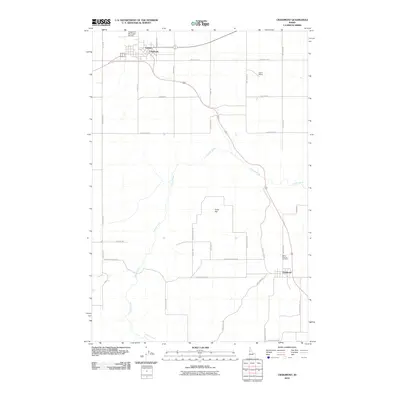
2010 Map of Craigmont
USGS Topo · Published 2010About this map
Craigmont and the adjacent community of Vollmer anchor the northern landscape of this Lewis County plateau, situated near the Craigmont Municipal Airport. The area is characterized by a high-prairie agricultural grid, where long thoroughfares like Meridian Rd and Westlake Rd connect isolated farmsteads and rural facilities. To the southeast, the town of Ferdinand sits along the primary highway corridor, marked by the presence of Saint Maurus Cemetery.
Find a feature on this map
34 named features on this map. Tap any name to fly to it.
Don’t see what you’re looking for? This feature index may not catch every label — zoom into the map to look around manually.
Map Details
Editions of this 2010 Craigmont Map
This is the sole edition of this map. No revisions or reprints were ever made.
Other maps of this area

1924 · Kamiah
USGS Topo · 1:125,000

1955 · Pullman
USGS Topo · 1:250,000

1958 · Pullman
USGS Topo · 1:250,000

1958 · Culdesac
USGS Topo · 1:62,500

1967 · Mohler
USGS Topo · 1:24,000

1967 · Fletcher
USGS Topo · 1:24,000

1967 · Craigmont
USGS Topo · 1:24,000

1967 · Westlake
USGS Topo · 1:24,000
1967 · Keuterville
USGS Topo · 1:24,000

1967 · Cottonwood NE
USGS Topo · 1:24,000