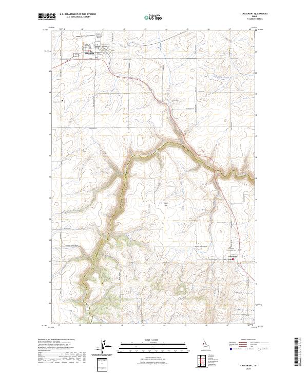
2024 Map of Craigmont
USGS Topo · Published 2024About this map
Craigmont and Ferdinand anchor this modern topographic survey of the Camas Prairie region, where the high plateau is deeply incised by the drainage of Lawyer Creek. The landscape transition is stark, moving from the grid-patterned agricultural lands of Icicle Flat to the steep, winding descent into the creek canyon. This geographic divide is mirrored in the transportation network, where the straight section lines of Evergreen Rd and Meridian Rd give way to the sinuous path of Old Hwy 95 as it follows the natural contours of the break. Local history is preserved in the location of the Craigmont Cem and Ferdinand Community Cem, while the modern utility of the area is represented by the Craigmont Municipal Airport on the northern edge of the township.
Find a feature on this map
53 named features on this map. Tap any name to fly to it.
Don’t see what you’re looking for? This feature index may not catch every label — zoom into the map to look around manually.
Map Details
Editions of this 2024 Craigmont Map
This is the sole edition of this map. No revisions or reprints were ever made.
Other maps of this area

1924 · Kamiah
USGS Topo · 1:125,000

1955 · Pullman
USGS Topo · 1:250,000

1958 · Pullman
USGS Topo · 1:250,000

1958 · Culdesac
USGS Topo · 1:62,500

1967 · Mohler
USGS Topo · 1:24,000

1967 · Fletcher
USGS Topo · 1:24,000

1967 · Craigmont
USGS Topo · 1:24,000

1967 · Westlake
USGS Topo · 1:24,000
1967 · Keuterville
USGS Topo · 1:24,000

1967 · Cottonwood NE
USGS Topo · 1:24,000