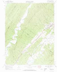
1967 Map of Craigsville
USGS Topo · Published 1969About this map
Craigsville and the industrial hamlet of Fordwick sit at the eastern base of North Mountain, where the Chesapeake and Ohio railroad corridor dictates the settlement pattern. This late 1960s survey documents a landscape defined by the convergence of the Calfpasture River and the Little Calfpasture River, with numerous limestone quarries indicating the local mineral economy. Cultural markers like the Drive-in Theater near Craigsville and the Lebanon Church further south suggest the social fabric of the era.
Find a feature on this map
61 named features on this map. Tap any name to fly to it.
Don’t see what you’re looking for? This feature index may not catch every label — zoom into the map to look around manually.
Map Details
Editions of this 1967 Craigsville Map
2 editions found
Other maps of this area

1894 · Staunton
USGS Topo · 1:125,000

1894 · Natural Bridge
USGS Topo · 1:125,000

1894 · Lexington
USGS Topo · 1:125,000

1901 · Monterey
USGS Topo · 1:125,000

1932 · Lexington
USGS Topo · 1:48,000

1937 · Lexington
USGS Topo · 1:62,500

1943 · Craigsville
USGS Topo · 1:62,500

1945 · Craigsville
USGS Topo · 1:62,500

1946 · Millboro
USGS Topo · 1:62,500

1946 · Williamsville
USGS Topo · 1:62,500