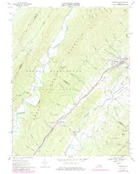
1967 Map of Craigsville
USGS Topo · Published 1978About this map
The Chesapeake and Ohio railroad corridor anchors the industrial and social life of this Shenandoah Valley landscape, cutting through the gap between North Mountain and Brown Ridge. At the town of Craigsville, the rail line serves as a central artery for local industry, evidenced by the multiple quarries and the proximity of Fordwick. This mid-century survey reflects a mix of traditional rural life and modern leisure, featuring a drive-in theater near the tracks while maintaining a network of old country roads and fords across the Great Calfpasture River.
Find a feature on this map
62 named features on this map. Tap any name to fly to it.
Don’t see what you’re looking for? This feature index may not catch every label — zoom into the map to look around manually.
Map Details
Editions of this 1967 Craigsville Map
2 editions found
Other maps of this area

1894 · Staunton
USGS Topo · 1:125,000

1894 · Natural Bridge
USGS Topo · 1:125,000

1894 · Lexington
USGS Topo · 1:125,000

1901 · Monterey
USGS Topo · 1:125,000

1932 · Lexington
USGS Topo · 1:48,000

1937 · Lexington
USGS Topo · 1:62,500

1943 · Craigsville
USGS Topo · 1:62,500

1945 · Craigsville
USGS Topo · 1:62,500

1946 · Millboro
USGS Topo · 1:62,500

1946 · Williamsville
USGS Topo · 1:62,500