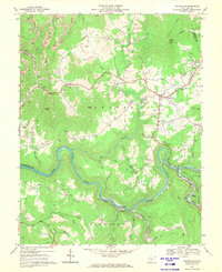
1966 Map of Craigsville
USGS Topo · Published 1970About this map
The Gauley River carves a deep, winding path through this central West Virginia landscape, where industrial activity and rural life meet along the river banks. In the late 1960s, the southern reach of Summersville Lake began to influence the terrain, while the Baltimore and Ohio railroad maintained its presence through the valley to serve local industry. Evidence of the region’s resource extraction is visible through numerous Strip Mines, Gas Wells, and a Coal Siding near Curtin.
Find a feature on this map
76 named features on this map. Tap any name to fly to it.
Don’t see what you’re looking for? This feature index may not catch every label — zoom into the map to look around manually.
Map Details
Editions of this 1966 Craigsville Map
2 editions found
Other maps of this area

1889 · Nicholas
USGS Topo · 1:125,000

1891 · Nicholas
USGS Topo · 1:125,000

1901 · Nicholas
USGS Topo · 1:125,000

1913 · Summersville
USGS Topo · 1:48,000

1914 · Winona
USGS Topo · 1:48,000

1915 · Cowen
USGS Topo · 1:48,000
1915 · Summersville
USGS Topo · 1:62,500

1916 · Winona
USGS Topo · 1:62,500

1917 · Cowen
USGS Topo · 1:62,500

1918 · Richwood
USGS Topo · 1:62,500