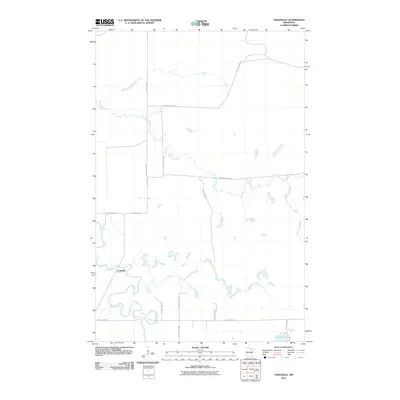
2010 Map of Craigville
USGS Topo · Published 2010About this map
The settlement of Craigville sits at a prominent bend in the Big Fork River, where the river's winding course dominates the southern half of this landscape. The waterway is punctuated by Little American Falls to the west, while the southeastern corner is anchored by the waters of Round Lake. This region of Koochiching County is defined by a network of rural roads and trails, including the Deer River Line and North Lofgrin Rd, which cut through the northern timberlands.
Find a feature on this map
16 named features on this map. Tap any name to fly to it.
Don’t see what you’re looking for? This feature index may not catch every label — zoom into the map to look around manually.
Map Details
Editions of this 2010 Craigville Map
This is the sole edition of this map. No revisions or reprints were ever made.
Other maps of this area

1919 · M
USGS Topo · 1:62,500

1954 · Hibbing
USGS Topo · 1:250,000

1954 · International Falls
USGS Topo · 1:250,000

1957 · Hibbing
USGS Topo · 1:250,000

1957 · International Falls
USGS Topo · 1:250,000

1958 · International Falls
USGS Topo · 1:250,000

1958 · Hibbing
USGS Topo · 1:250,000

1964 · Hibbing
USGS Topo · 1:250,000

1970 · Johnson Landing SE
USGS Topo · 1:24,000
1970 · Deer Lake NW
USGS Topo · 1:24,000