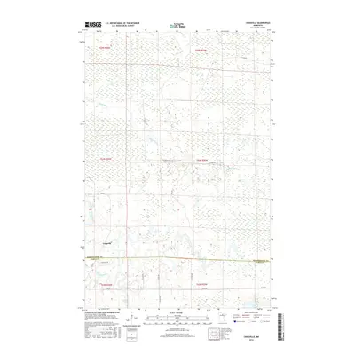
2016 Map of Craigville
USGS Topo · Published 2016About this map
Craigville sits at the heart of this Northwoods landscape, where the Big Fork River carves a winding path through dense wetlands and timber country. The map highlights the river's dynamic character, marking specific navigational hazards and landmarks like Little American Falls and Muldoon Rapids. The surrounding terrain is defined by an extensive network of drainage and small waterways, including the meandering Reilly Brook which feeds into the larger river system.
Find a feature on this map
26 named features on this map. Tap any name to fly to it.
Don’t see what you’re looking for? This feature index may not catch every label — zoom into the map to look around manually.
Map Details
Editions of this 2016 Craigville Map
This is the sole edition of this map. No revisions or reprints were ever made.
Other maps of this area

1919 · M
USGS Topo · 1:62,500

1954 · Hibbing
USGS Topo · 1:250,000

1954 · International Falls
USGS Topo · 1:250,000

1957 · Hibbing
USGS Topo · 1:250,000

1957 · International Falls
USGS Topo · 1:250,000

1958 · International Falls
USGS Topo · 1:250,000

1958 · Hibbing
USGS Topo · 1:250,000

1964 · Hibbing
USGS Topo · 1:250,000

1970 · Johnson Landing SE
USGS Topo · 1:24,000
1970 · Deer Lake NW
USGS Topo · 1:24,000