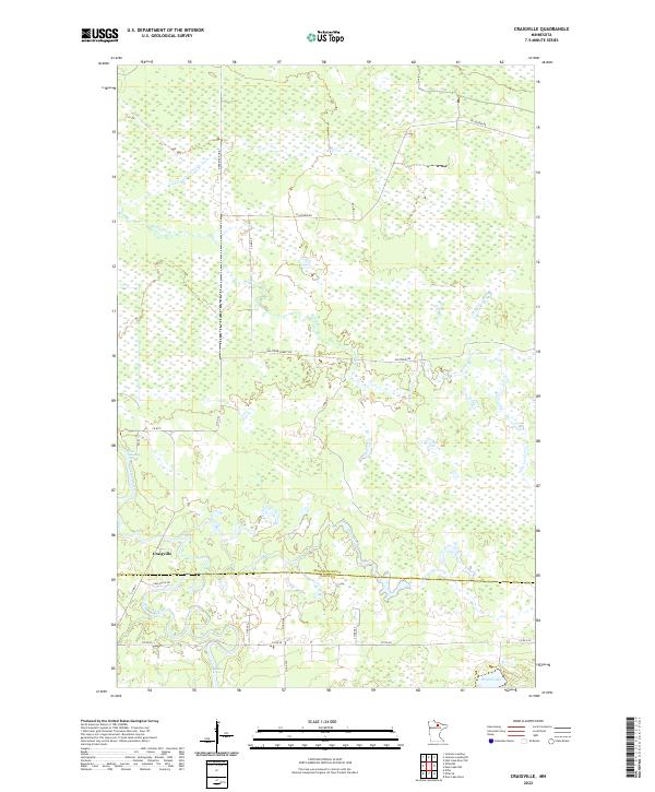
2022 Map of Craigville
USGS Topo · Published 2022About this map
Craigville sits at the intersection of local logging and forest roads within the low-lying wetlands of northern Minnesota. The Big Fork River meanders through the southern portion of the quadrangle, notably passing through the Muldoon Rapids before crossing the boundary line between Koochiching Co and Itasca Co. This terrain is characterized by an extensive network of drainage features, including Reilly Brook and several unnamed marshlands that dominate the northern townships. The presence of the Deer River Line and named thoroughfares such as Holstrom Forest Rd and N Lofgrin Rd trace the path of historical timber access and rural connectivity. In the southeast corner, Round Lake provides a distinct break in the saturated landscape, serving as a landmark near the junction of Co Rd 40 and Co Rd 525.
Find a feature on this map
25 named features on this map. Tap any name to fly to it.
Don’t see what you’re looking for? This feature index may not catch every label — zoom into the map to look around manually.
Map Details
Editions of this 2022 Craigville Map
This is the sole edition of this map. No revisions or reprints were ever made.
Other maps of this area

1919 · M
USGS Topo · 1:62,500

1954 · Hibbing
USGS Topo · 1:250,000

1954 · International Falls
USGS Topo · 1:250,000

1957 · Hibbing
USGS Topo · 1:250,000

1957 · International Falls
USGS Topo · 1:250,000

1958 · International Falls
USGS Topo · 1:250,000

1958 · Hibbing
USGS Topo · 1:250,000

1964 · Hibbing
USGS Topo · 1:250,000

1970 · Johnson Landing SE
USGS Topo · 1:24,000
1970 · Deer Lake NW
USGS Topo · 1:24,000