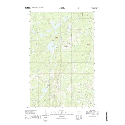
2019 Map of Cramer
USGS Topo · Published 2019About this map
Cramer sits at the heart of this landscape, surrounded by the dense woodlands and complex hydrology of the Superior National Forest. This section of the Arrowhead Region is characterized by a high density of water bodies, from the sprawling Ninemile Lake and Cramer Lake to smaller basins like Paccini Lake and Kowalski Lake. The terrain is shaped by the presence of the Sawtooth Mountains in the southeast, which influence the drainage patterns of the Manitou River and the Caribou River. Transportation through this timbered area relies on a network of forest roads and trails, including the N Shore State Trail and the Hare Lake Snowmo Connector. The map illustrates a region where recreational use and natural resource management define the land, with distinct boundaries between Lake and Cook counties following the ridge lines and watersheds.
Find a feature on this map
37 named features on this map. Tap any name to fly to it.
Don’t see what you’re looking for? This feature index may not catch every label — zoom into the map to look around manually.
Map Details
Editions of this 2019 Cramer Map
This is the sole edition of this map. No revisions or reprints were ever made.
Other maps of this area

1954 · Two Harbors
USGS Topo · 1:250,000

1955 · Schroeder
USGS Topo · 1:24,000

1955 · Tofte
USGS Topo · 1:62,500

1955 · Cramer
USGS Topo · 1:62,500

1956 · Little Marais
USGS Topo · 1:24,000

1956 · Finland
USGS Topo · 1:24,000

1956 · Finland
USGS Topo · 1:62,500

1957 · Two Harbors
USGS Topo · 1:250,000

1958 · Two Harbors
USGS Topo · 1:250,000

1964 · Two Harbors
USGS Topo · 1:250,000