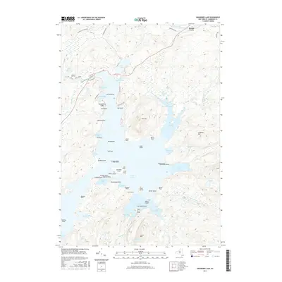
2016 Map of Cranberry Lake
USGS Topo · Published 2016About this map
Cranberry Lake dominates this wilderness landscape within the Adirondack Park Preserve, characterized by an intricate shoreline of deep bays and numerous islands. The map details the northern reaches of the park where the Oswegatchie River exits the lake, winding through the woods near Tooley Pond Rd. The terrain is marked by significant water bodies such as Silver Lake, Dillon Pond, and the expansive Brandy Brook Flow. Numerous named landforms like Bear Mtn and Hedgehog Mtn rise above the wetlands and bays, including Matilda Bay and Thompson Bay. This 2016 survey illustrates the balance of managed wilderness and small-scale human presence, featuring local landmarks like the Cranberry Lake Cem and the Pub Campsite Rd providing access to the eastern shore of Matilda Island.
Find a feature on this map
79 named features on this map. Tap any name to fly to it.
Don’t see what you’re looking for? This feature index may not catch every label — zoom into the map to look around manually.
Map Details
Editions of this 2016 Cranberry Lake Map
This is the sole edition of this map. No revisions or reprints were ever made.
Other maps of this area

1907 · Tupper Lake
USGS Topo · 1:62,500

1919 · Cranberry Lake
USGS Topo · 1:62,500

1920 · Childwold
USGS Topo · 1:62,500

1921 · Cranberry Lake
USGS Topo · 1:62,500

1921 · Childwold
USGS Topo · 1:48,000

1921 · Stark
USGS Topo · 1:62,500

1922 · Childwold
USGS Topo · 1:62,500

1923 · Stark
USGS Topo · 1:62,500

1931 · Cranberry Lake
USGS Topo · 1:62,500

1940 · Stark
USGS Topo · 1:62,500