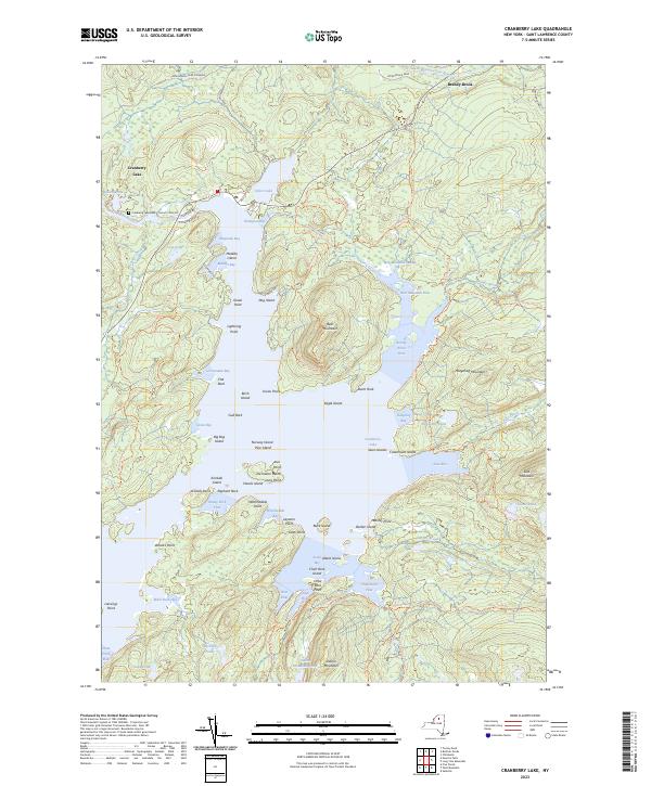
2023 Map of Cranberry Lake
USGS Topo · Published 2023About this map
The Oswegatchie River and the South Branch Grass River define the intricate waterways of the Adirondack Park near the community of Cranberry Lake. This terrain is characterized by a complex network of bays, points, and islands, including Joe Indian Island, Eagle Island, and Matilda Island. The map shows a highly developed trail system for modern recreation, featuring the Peavine Swamp Ski Trl, Cranberry Lake 50 East Connector Trl, and Olmstead Pond Loop Trl.
Find a feature on this map
90 named features on this map. Tap any name to fly to it.
Don’t see what you’re looking for? This feature index may not catch every label — zoom into the map to look around manually.
Map Details
Editions of this 2023 Cranberry Lake Map
This is the sole edition of this map. No revisions or reprints were ever made.
Other maps of this area

1907 · Tupper Lake
USGS Topo · 1:62,500

1919 · Cranberry Lake
USGS Topo · 1:62,500

1920 · Childwold
USGS Topo · 1:62,500

1921 · Cranberry Lake
USGS Topo · 1:62,500

1921 · Childwold
USGS Topo · 1:48,000

1921 · Stark
USGS Topo · 1:62,500

1922 · Childwold
USGS Topo · 1:62,500

1923 · Stark
USGS Topo · 1:62,500

1931 · Cranberry Lake
USGS Topo · 1:62,500

1940 · Stark
USGS Topo · 1:62,500