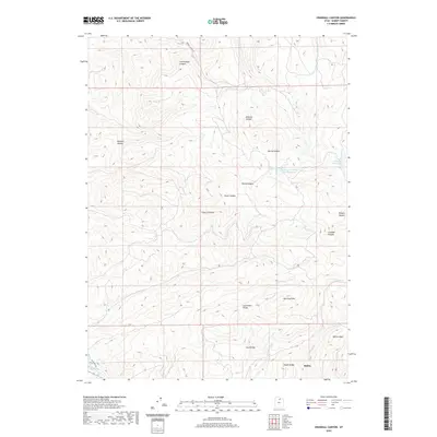
2020 Map of Crandall Canyon
USGS Topo · Published 2020About this map
Oakley sits at the southwestern edge of this landscape, where the Weber River winds through the valley floor and State Rte 302 provides access to the higher elevations. The terrain is defined by a series of significant canyons including Crandall Canyon, Cherry Canyon, and Dunford Canyon, which drain the ridges that separate the various water basins. These topographic features illustrate a complex watershed system where Rasmussen Cr and Post Cr flow south toward the valley.
Find a feature on this map
24 named features on this map. Tap any name to fly to it.
Don’t see what you’re looking for? This feature index may not catch every label — zoom into the map to look around manually.
Map Details
Editions of this 2020 Crandall Canyon Map
This is the sole edition of this map. No revisions or reprints were ever made.
Other maps of this area

1885 · Salt Lake
USGS Topo · 1:250,000

1900 · Coalville
USGS Topo · 1:125,000

1903 · Coalville
USGS Topo · 1:125,000

1954 · Salt Lake City
USGS Topo · 1:250,000

1955 · Park City East
USGS Topo · 1:24,000

1958 · Salt Lake City
USGS Topo · 1:250,000

1960 · Salt Lake City
USGS Topo · 1:250,000
1967 · Turner Hollow
USGS Topo · 1:24,000

1967 · Kamas
USGS Topo · 1:24,000
1967 · Wanship
USGS Topo · 1:24,000