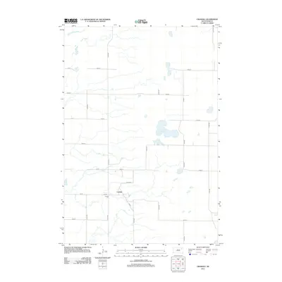
2012 Map of Crandall
USGS Topo · Published 2012About this map
Crandall sits at the heart of this Day County landscape, a small settlement defined by its grid of rural routes. The surrounding prairie is dotted with ephemeral and permanent water bodies, most notably the expansive Sweetwater Lake and the isolated Lone Tree Lake to the southeast. For those researching local family history, the Crandall Cem is a primary landmark situated just south of the main township area. The terrain is organized by a systematic network of section roads, including Co Rd-1 and Co Rd-37, which navigate the complex drainage patterns of the region. This 2012 survey captures the area at a time when the agricultural footprint and the natural hydrology of the Dakotas remained the primary features of the land.
Find a feature on this map
23 named features on this map. Tap any name to fly to it.
Don’t see what you’re looking for? This feature index may not catch every label — zoom into the map to look around manually.
Map Details
Editions of this 2012 Crandall Map
This is the sole edition of this map. No revisions or reprints were ever made.
Other maps of this area

1894 · Conde
USGS Topo · 1:62,500

1895 · Aberdeen
USGS Topo · 1:125,000

1953 · Milbank
USGS Topo · 1:250,000

1954 · Ferney
USGS Topo · 1:24,000

1954 · Aberdeen
USGS Topo · 1:250,000

1956 · Aberdeen
USGS Topo · 1:250,000

1958 · Milbank
USGS Topo · 1:250,000
1958 · Conde
USGS Topo · 1:24,000

1958 · Andover SW
USGS Topo · 1:24,000
1958 · Crandall
USGS Topo · 1:24,000