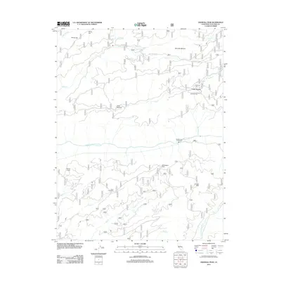
2012 Map of Crandall Peak
USGS Topo · Published 2012About this map
The Middle Fork Stanislaus River and S Fork Stanislaus River anchor this Tuolumne County landscape, providing a clear view of the area's recreational and seasonal geography. The presence of Camp Pendola, the Camp John Mensinger Boy Scout Camp, and Eagle Creek Camp indicates a legacy of forest retreats and organized youth camping in the high country.
Find a feature on this map
27 named features on this map. Tap any name to fly to it.
Don’t see what you’re looking for? This feature index may not catch every label — zoom into the map to look around manually.
Map Details
Editions of this 2012 Crandall Peak Map
This is the sole edition of this map. No revisions or reprints were ever made.
Other maps of this area

1891 · Big Trees
USGS Topo · 1:125,000

1894 · Big Trees
USGS Topo · 1:125,000

1897 · Big Trees
USGS Topo · 1:125,000

1901 · Big Trees
USGS Topo · 1:125,000

1947 · Sacramento
USGS Topo · 1:250,000

1948 · Sacramento
USGS Topo · 1:250,000

1948 · Columbia
USGS Topo · 1:62,500
1948 · Columbia SE
USGS Topo · 1:24,000

1948 · Stanislaus
USGS Topo · 1:24,000
1949 · Columbia SE
USGS Topo · 1:24,000