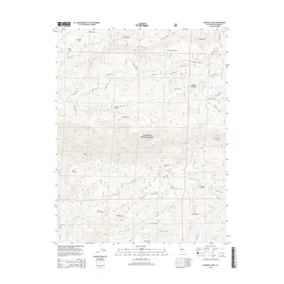
2015 Map of Crandall Peak
USGS Topo · Published 2015About this map
Stanislaus National Forest defines the character of this Tuolumne County terrain, where the Middle-Fork Stanislaus River carves through deep canyons and high ridges. The landscape is marked by significant topographical landmarks such as Crandall Peak and Mt Knight, with many high-altitude meadows including Grohl Meadow and Schumake Meadow providing breaks in the timber. A complex network of forest routes, such as Forest Rte 5N20 and Forest Rte 4N15, provides access to remote locations like Camp Pendola.
Find a feature on this map
56 named features on this map. Tap any name to fly to it.
Don’t see what you’re looking for? This feature index may not catch every label — zoom into the map to look around manually.
Map Details
Editions of this 2015 Crandall Peak Map
This is the sole edition of this map. No revisions or reprints were ever made.
Other maps of this area

1891 · Big Trees
USGS Topo · 1:125,000

1894 · Big Trees
USGS Topo · 1:125,000

1897 · Big Trees
USGS Topo · 1:125,000

1901 · Big Trees
USGS Topo · 1:125,000

1947 · Sacramento
USGS Topo · 1:250,000

1948 · Sacramento
USGS Topo · 1:250,000

1948 · Columbia
USGS Topo · 1:62,500
1948 · Columbia SE
USGS Topo · 1:24,000

1948 · Stanislaus
USGS Topo · 1:24,000
1949 · Columbia SE
USGS Topo · 1:24,000