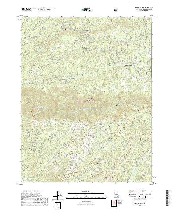
2021 Map of Crandall Peak
USGS Topo · Published 2021About this map
The Stanislaus National Forest landscape is defined by the steep canyons carved by the Middle Fork Stanislaus River and the S Fork Stanislaus River. This 2021 topographic map documents the intricate network of forest roads and specialized trails used for recreation and management, including the Tunnel Cr R/R Grade Trl and various routes like the Crandall Peak Ohv-4x4 Trl. High-elevation landmarks such as Crandall Peak, Mt Knight, and Grant Ridge provide significant vertical relief above meadows like Schumake Meadow and Grohl Meadow.
Find a feature on this map
65 named features on this map. Tap any name to fly to it.
Don’t see what you’re looking for? This feature index may not catch every label — zoom into the map to look around manually.
Map Details
Editions of this 2021 Crandall Peak Map
This is the sole edition of this map. No revisions or reprints were ever made.
Other maps of this area

1891 · Big Trees
USGS Topo · 1:125,000

1894 · Big Trees
USGS Topo · 1:125,000

1897 · Big Trees
USGS Topo · 1:125,000

1901 · Big Trees
USGS Topo · 1:125,000

1947 · Sacramento
USGS Topo · 1:250,000

1948 · Sacramento
USGS Topo · 1:250,000

1948 · Columbia
USGS Topo · 1:62,500
1948 · Columbia SE
USGS Topo · 1:24,000

1948 · Stanislaus
USGS Topo · 1:24,000
1949 · Columbia SE
USGS Topo · 1:24,000